About Yushan

Sunrise over Yushan / Liao Chi-Chun

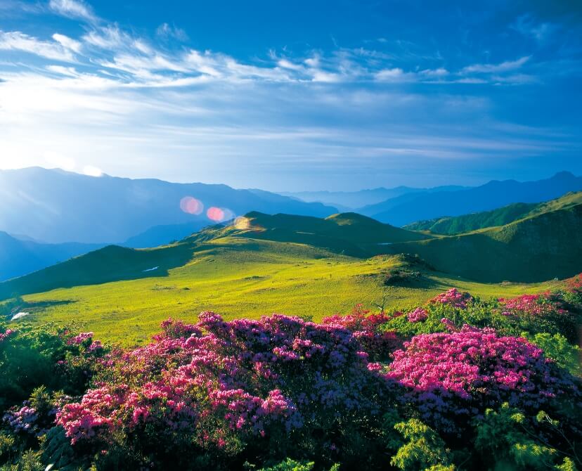
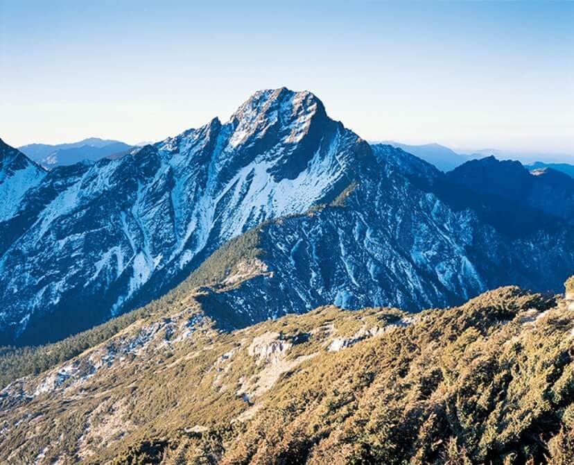
The Main Peak of Yushan is 3,952 meters above sea level. It is the tallest mountain in Taiwan, and the highest peak out of the 100 Peaks of Taiwan. It is also the highest peak in Northeast Asia.
Named after the tallest mountain in Taiwan, E.SUN Bank endeavors to become the best and most popular bank.

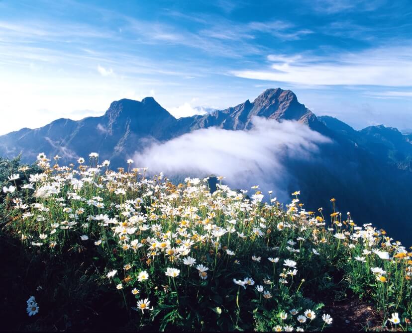
Main PeakLocated in the center of Taiwan, at 3,952 meters above sea level, it is the tallest mountain in Taiwan, and the highest peak out of the 100 Peaks of Taiwan. It is also the highest peak in Northeast Asia.

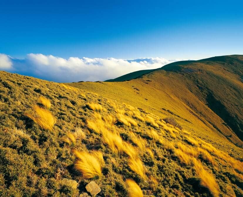
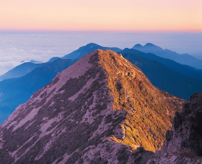
East PeakLocated on the east side of the Main Peak of Yushan, 3,869 meters above sea level, it is one of the peaks in the Yushan, and the third highest peak out of the 100 Peaks of Taiwan.

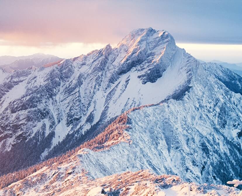
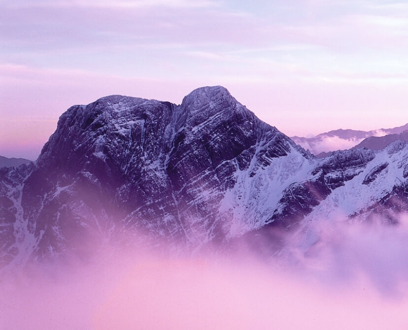
North PeakThe North Peak of Yushan is 3,858 meters high. It was known as the North Mountain, New High North Mountain, and Douliu New High Peak during the Japanese colonial period. It is one peak away from Yushan’s Northern North Peak, and is shaped like a camel’s hump, which is why it was called Tiantuo Peak (“Camel Peak”) by Taiwanese mountaineer Xing Tian-Zheng.

South PeakThe South Peak of Yushan is 3,844 meters high, and was known as the South Mountain and New High South Mountain during the Japanese colonial rule. It is also known as Tianlong Peak (“Dragon Peak”) because of its resemblance to a flying dragon when viewed from the Main Peak.

Source: Wikipedia, Yushan National Park, National Parks of Taiwan
If there are any errors in the information on this website, please contact us.

Located in the central part of Taiwan, Yushan National Park has a subtropical climate with temperate alpine and cold climate zones. It snows in winter and is cool in summer. The elevation ranges from 300 meters at the eastern Lakulaku River valley to 3,952 meters at the Main Peak, and the temperature varies greatly with the altitude. The four seasons of Yushan are distinct and beautiful: the azaleas bloom in the spring, there are cloud seas in the summer, oxeye daisies bloom in the autumn, and snow is as white as jade in the winter, making “Snow-capped Yushan” one of the eight scenic attractions in Taiwan.

Source: Wikipedia, Yushan National Park, National Parks of Taiwan
If there are any errors in the information on this website, please contact us.

The topography and climate of Yushan National Park are richly varied, giving rise to diverse animal and plant species, and a wealth of ecological resources.

Alpine Vegetation ZoneMainly located above 3,600 meters, common plants include azaleas, flaky junipers, and Morrison Stonecrop.

Fir ForestIt is located between 3,100 and 3,600 meters above sea level, i.e., below the alpine vegetation zone and near the top of mountain ridges, where the sun’s radiation is extremely strong. Common plants include the Taiwan White Fir.


Formosan Black BearThe Formosan black bear is a subspecies of the Asian black bear that is endemic to Taiwan. The V-shaped white markings on their chests are a common feature of Asian black bears.

Formosan Sambar DeerThe Formosan sambar deer is a subspecies endemic to Taiwan. It is a crepuscular animal, and inhabits primeval forests at mid to high altitudes above 1,000 meters in elevation. It is most commonly seen in grasslands near water sources.

Formosan Yellow-throated MartenIt has a bright yellow neck, black feet and tail, white jaws and throat, and a long, cylindrical body. It inhabits broad-leaved forests, coniferous forests, and arrow bamboo forests.

Source: Wikipedia, Yushan National Park, National Parks of Taiwan
If there are any errors in the information on this website, please contact us.

Descriptions found in historical texts include a statement in a book titled “Supplementary Notes on the Wild Territories” written by Yu Yonghe during the reign of Emperor Kangxi of the Qing Dynasty (1697): “Yushan is king among ten thousand mountains. Its mountains are unique and high. It can be seen from afar. It is steep and craggy. It is white as silver. From afar, it looks like snow from the heavens. It is surrounded by peaks on all sides. It is unreachable. It is said that this mountain is as solid as jade.”
During the Japanese colonial period in Taiwan, the Japanese found that Yushan was taller than Mount Fuji, so in the 30th year of the Meiji era, the Emperor Meiji named it “Mount Niitaka.” After the Republic of China was established, the name of the mountain was officially changed to Yushan and announced on December 1, 1947.
Yushan has been a very important mountain for indigenous peoples since ancient times, and is considered a sacred mountain by the Bunun and Tsou people.

The BununThe Bunun people call Yushan “Tongu Saviec,” which means “the mountain that provides refuge,” because the Bunun say that in ancient times, when the land was flooded, only Yushan still offered shelter.


The TsouAccording to legend, their ancestors lived at the top of Yushan and called it “pattonkan,” which has been transliterated to “Batongguan” in Chinese. It means “shining mountain” or “mountain of quartz.”

Source: Wikipedia, Yushan National Park, National Parks of Taiwan
If there are any errors in the information on this website, please contact us.

Eight Scenes of Mount NiitakaThis refers to the eight scenic views of Taiwan’s Mount Niitaka (Yushan), which were decided by a vote of the Chiayi County Police Department in 1929.

  • Sunset on the East Mountain: East Mount Niitaka
  • Flowers in Shihshan: Shihshan
  • A Sea of Clouds in Lulin: Lulinshan
  • Fu Valley Rocks: Fu Valley
  • Memaizaka Overlook: Memaizaka
  • West Mountain Plains: West Mount Niitaka
  • View of the White Forest: White Forest
  • Sunrise on the Main Peak: Main Peak of Mount Niitaka

Nearby AttractionsSpanning the four counties of Nantou, Chiayi, Hualien and Kaohsiung, the Yushan National Park is the largest national park in Taiwan. It covers a vast area, and is surrounded by diverse geographical landscapes.

  • Jiaming Lake
    Located at an altitude of 3,300 meters, Jiaming Lake is called “the mirror of the moon” by the Bunun people because of the deep blue color of the lake; for the same reason, it is called “God's lost sapphire on earth” and “angels’ tears” by the mountaineering community. It has become a famous mountain attraction in Taiwan in recent years.
  • Tataka
    In the language of the Tsou people, it means a wide, flat expanse of grassland. Tataka is the highest point on the New Central Cross-Island Highway at an altitude of 2,610 meters, and is located in the northwest part of Yushan National Park.
    The Tataka area has a view of the Main Peak and its surrounding high peaks to the east, and the Zhushan and Tashan mountain ranges to the west across the Shenmu River. In the early mornings and evenings, seas of clouds and mountain mist often form in the mountain valleys.
  • Walami Trail
    The Walami Trail is a 14-km long trail located in the eastern part of the Yushan National Park. The trail was planned along the Batongguan Traversing Trail built by the Japanese, and forms a part of the eastern section of the Batongguan Traversing Trail.
  • Batongguan
    Also known as “Pantounkua” or “Pattonkuan” in the olden days, it refers to the peaks and mountains in the Yushan area. The Batongguan Trail was originally the “Batongguan Mountain Pass” during the Japanese colonial rule. It was built in 1921 as a trail for the Japanese to implement the Indigenous Management Policy and to connect the eastern and western parts of Taiwan. It is currently listed as a National Monument.

Source: Wikipedia, Yushan National Park, National Parks of Taiwan
If there are any errors in the information on this website, please contact us.